Magnetic North
Single-channel projection, Field recording, dynamic measurements, 19:00
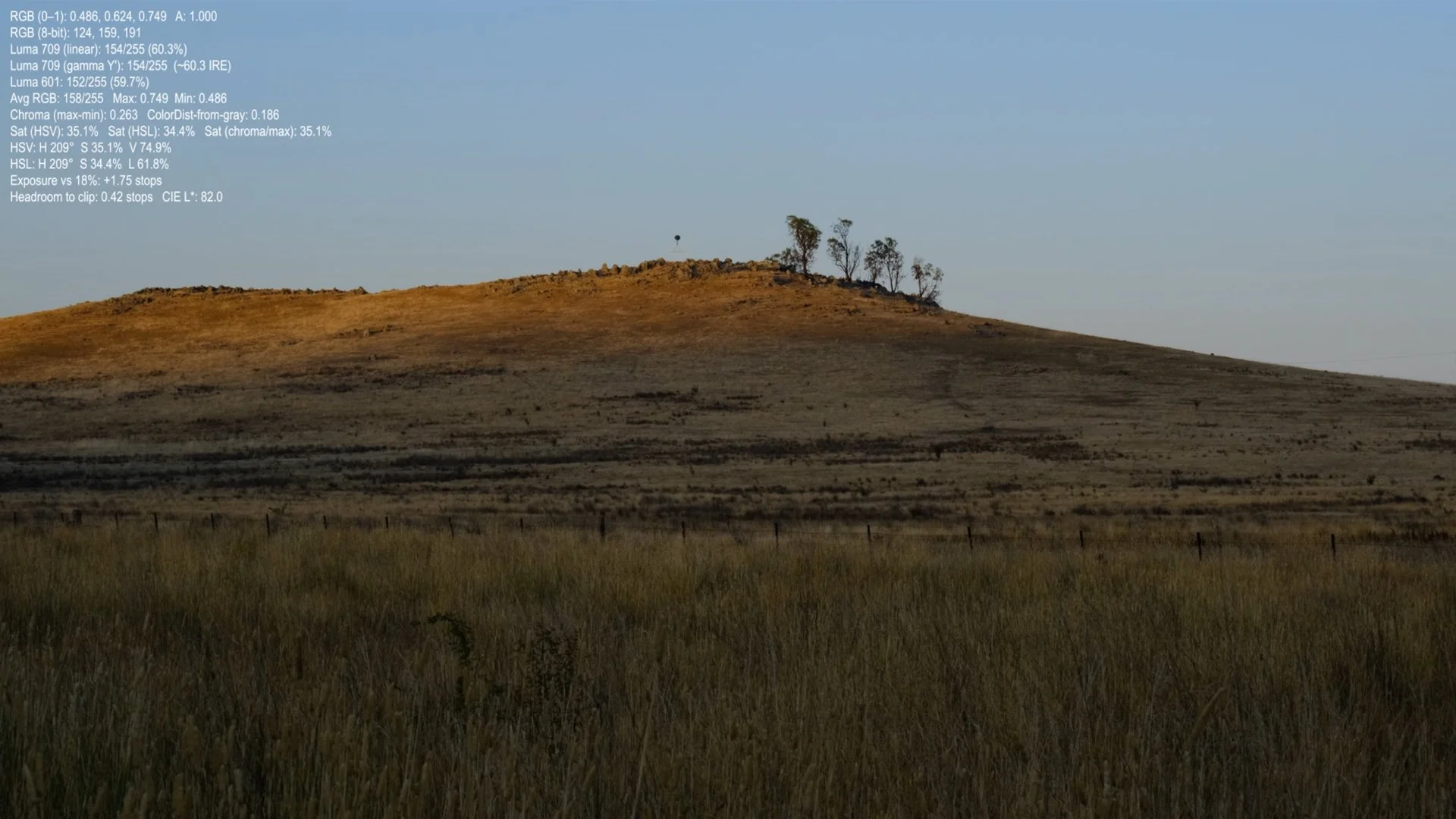
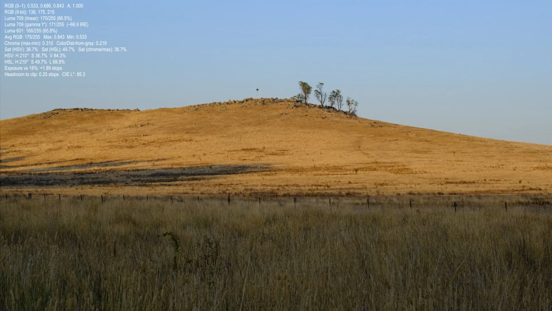

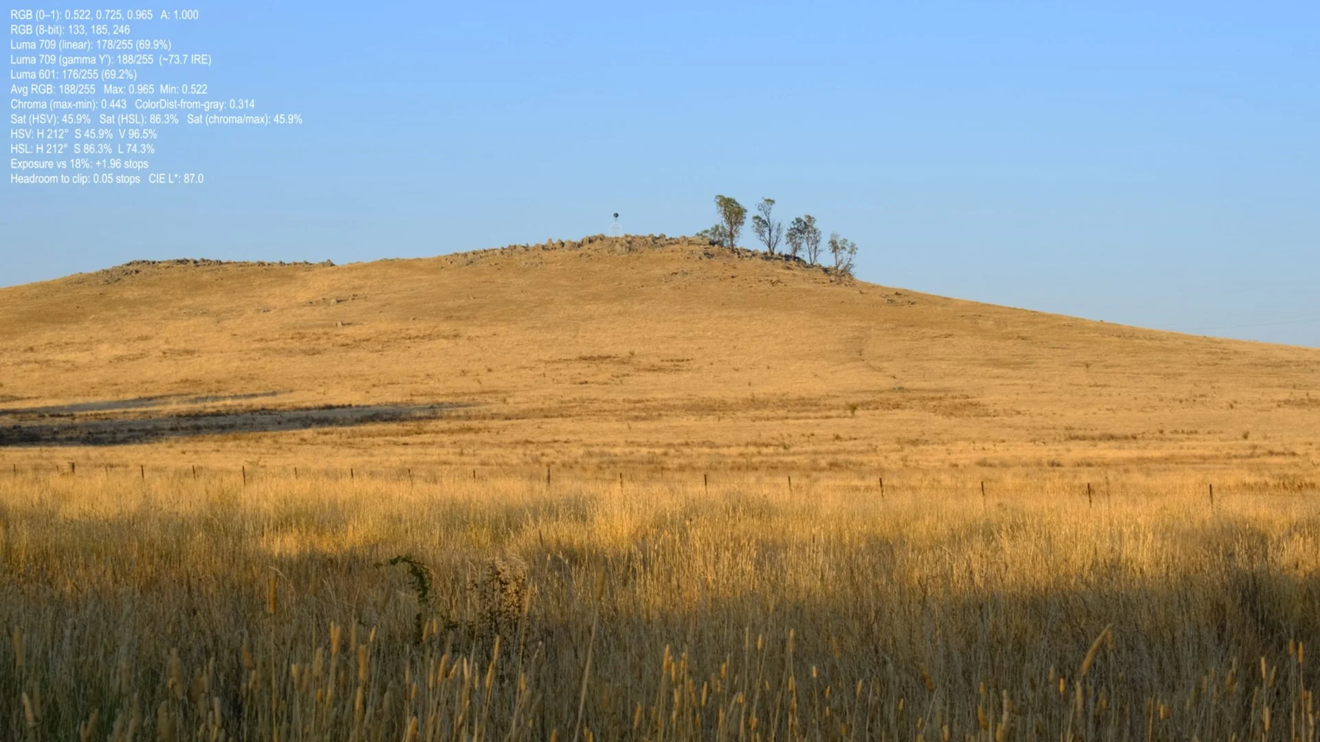
A view towards trigonometry station, a fixed geodetic survey point used to stabilise mapped space, as the sun rises
In the top left corner of the scene are a series of numbers that change in response to the image in view. These figures are generated by sampling the video at a chosen point and converting that a pixel range into several measurement readouts: luminance (how bright it is), exposure in stops (how far it sits above or below a mid-grey reference), and colour intensity measures such as saturation and chroma (how far the colour departs from neutral grey). Updating frame by frame, the overlay translates luminosity and radiance into quantified values.
In the still, open sky, the values take the space of a numeric cloud: a thin, persistent formation that hovers over the landscape and keeps changing as the light changes. Across the hill, the sunrise moves as a slow front: shadows withdraw, the slope warms, and the measured point drifts through different ranges of brightness and colour. The distant trig point remains small and steady on the horizon.